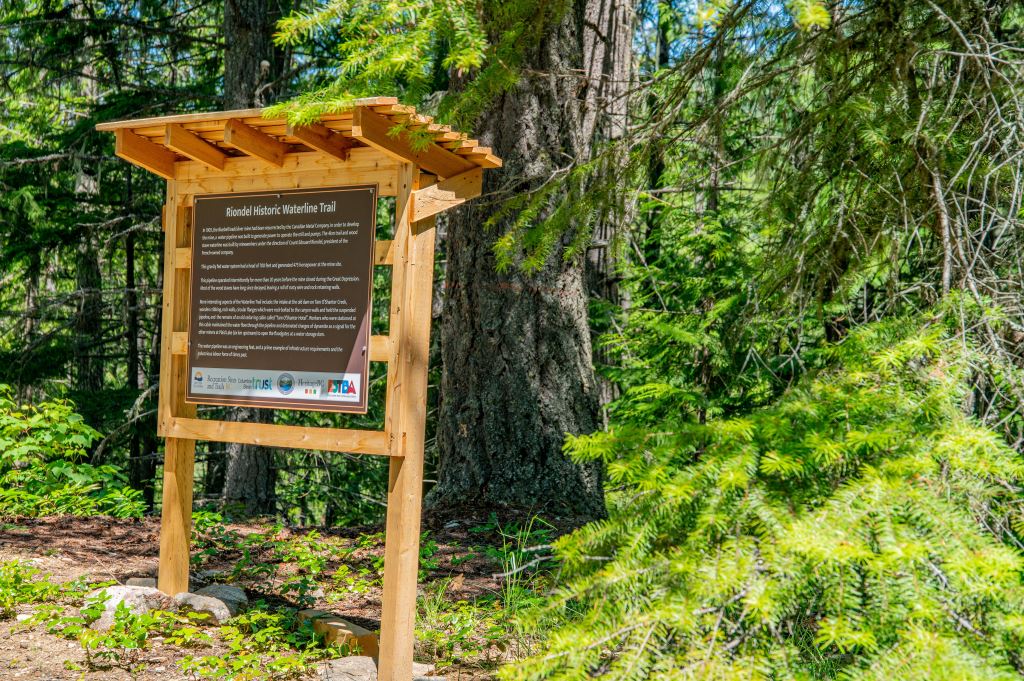

Hikers are rediscovering an historical trail north of Riondel, originally built as part of a wood stave pipeline that served the Bluebell mine.
The East Shore Trail and Bike Association has taken over management of the four-kilometre trail, whose highlights include the remnants of a dam, a log cabin, and the waterline itself.
The trail was used from about 1905 until the mid-1930s, when water drawn from the Tam O’Shanter Creek canyon was gravity fed to the mine, where it operated the mill and pumps. While it continued to be used thereafter by the community to explore the mountainside, it received little maintenance.
It was identified more than a decade ago by the Regional District of Central Kootenay as a potential community asset. But executive director Farley Cursons says they knew it would be a big job to provide access to the route and upgrade it so that it could be safely crossed.
“Perhaps every few years one local hiker went in and cleared it out, but it had significant downfall,” he says.
“Some areas were eroding. Most notably there were the remnants of this water line, which is just a ton of wrapped wire coils that go along beside and underneath the trail. We had to make that as safe as possible for people to get around and get over.”
The Columbia Basin Trust and regional district provided funding for the project, which took occurred starting last spring and took about eight months in all. Now that the project is complete with signage and sign-in boxes, Cursons says people from all over the region are starting to use the trail.
“You’ll talk to locals who grew up here who always knew it was there and explored it once or twice, including people who grew up in this area but have moved away. Since we since built it and have been promoting it, it’s seen a huge number of people.”
The trail includes two major footbridges with handrails and three boardwalks.
There are two ways to access it. You can travel one kilometer north of the local marina on Riondel North Road to the bottom trailhead and then a one-kilometer climb will take you up to the 1905 trail.
As you ascend the Tam O’Shanter Creek canyon, the remnants of the waterline will be beside you. Alternatively, you can drive up Tam O’Shanter Forest Service Road for 2.5 km to get directly to the trailhead of the canyon segment, which has the historical features, including what’s left of an old log cabin (dubbed the Tam O’Shanter Hotel) where workers stayed to maintain the pipeline, as well as wooden cribbing and the dam intake. There are also some circular flanges bolted to rocks on the canyon wall, where the pipeline would have been suspended.
“This project has been an amazing opportunity for our area,” says Cursons. “The Trust grant helped us create our own unique recreation trail destination that is quickly being discovered.”