Updated: In the interest of public and responder safety, this area restriction takes effect immediately and remains in force until the earlier of 12:00 noon (PDT) on October 15, or until the Order is rescinded.
This Order applies to Crown land within the geographic boundaries described below and as outlined on the attached map:
- Commencing at the bridge over Porcupine creek at 12 Km Porcupine Creek Road, then directly uphill due north to the height of land
- Following the height of land north through Trog Peak, Myth Peak to the top of Baldy Mountain (49°20.65,-117 3.65), then East to follow Laib Creek downstream to the bridge at Next Creek Road
- Follow the north side of Next Creek Road South West along Cultus Creek until the road turns south (49°17.59’N, 116°54.39’W), then head southwest along the height of land between Cultus Creek and Elmo Creek back to Porcupine creek at the point of commencement.
Original story
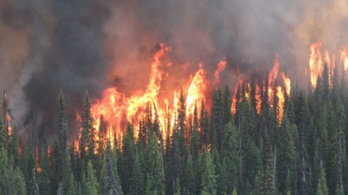
A wildfire east of Ymir has grown to 335 hectares after two smaller fires merged together.
The fire at Cultus Creek was discovered on Aug. 30 and is believed to have been caused by lightning.
The BC Wildfire Service says the out-of-control blaze is burning in steep, inaccessible terrain that is unsafe for ground crews to access.
Instead, the fire is being monitored and managed using a combination of techniques aimed at minimizing damage while maximizing potential ecological benefits.
(CORRECTION: An earlier version of this story said the fire was west of Ymir.)
Want to get your business noticed? Have you considered advertising through your local radio station? Speak to one of our sales agents and find out how radio advertising can boost your business today. Call 250-365-7600 or email Vista Radio.


